File:Haishen 2020-09-05 0425Z.jpg
Jump to navigation
Jump to search

Size of this preview: 450 × 600 pixels. Other resolutions: 180 × 240 pixels | 360 × 480 pixels | 576 × 768 pixels | 768 × 1,024 pixels | 1,536 × 2,048 pixels | 4,800 × 6,400 pixels.
Original file (4,800 × 6,400 pixels, file size: 7.31 MB, MIME type: image/jpeg)
Captions
Captions
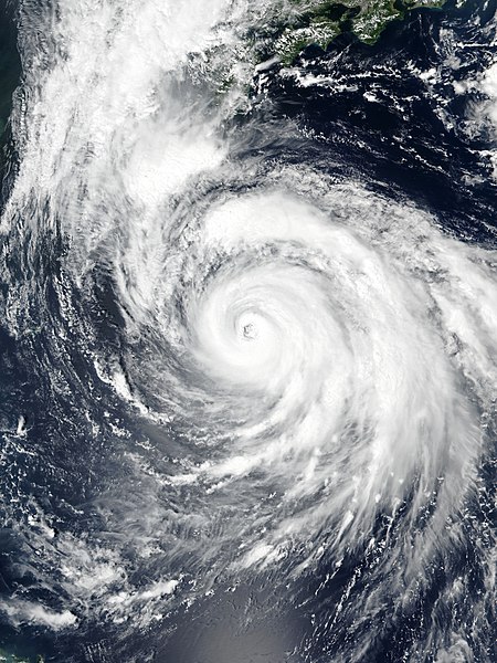
Typhoon Haishen on September 5
Summary[edit]
| Description |
English: Typhoon Haishen approaching the Ryukyu Islands on September 5, 2020. |
| Date | |
| Source | EOSDIS Worldview |
| Author | NOAA’s Suomi NPP satellite for the VIIRS imagery |
| Camera location | | View this and other nearby images on: OpenStreetMap |
|---|
Licensing[edit]
| This file is in the public domain in the United States because it was solely created by NASA. NASA copyright policy states that "NASA material is not protected by copyright unless noted". (See Template:PD-USGov, NASA copyright policy page or JPL Image Use Policy.) | ||
 |
Warnings:
|
File history
Click on a date/time to view the file as it appeared at that time.
| Date/Time | Thumbnail | Dimensions | User | Comment | |
|---|---|---|---|---|---|
| current | 11:19, 5 September 2020 | | 4,800 × 6,400 (7.31 MB) | Meow (talk | contribs) | Uploaded a work by NOAA’s Suomi NPP satellite for the VIIRS imagery from [https://worldview.earthdata.nasa.gov/?v=121.0353982300887,17.215465984513234,141.5817892699117,29.66077848451322&l=Reference_Labels,Reference_Features,Coastlines,OrbitTracks_Suomi_NPP_Ascending(hidden),VIIRS_SNPP_CorrectedReflectance_TrueColor EOSDIS Worldview] with UploadWizard |
You cannot overwrite this file.
File usage on Commons
There are no pages that use this file.