File:Maysak 2020-09-01 0450Z.jpg
Jump to navigation
Jump to search

Size of this preview: 450 × 600 pixels. Other resolutions: 180 × 240 pixels | 360 × 480 pixels | 576 × 768 pixels | 768 × 1,024 pixels | 1,536 × 2,048 pixels | 4,095 × 5,460 pixels.
Original file (4,095 × 5,460 pixels, file size: 5.93 MB, MIME type: image/jpeg)
Captions
Captions
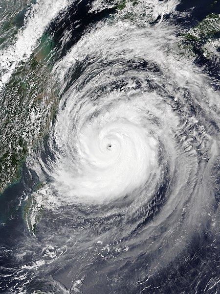
Typhoon Maysak (2020)
Summary[edit]
| Description |
English: Typhoon Maysak at peak intensity near Okinawa on September 1, 2020. |
| Date | |
| Source | EOSDIS Worldview |
| Author | NOAA-20 satellite for the VIIRS imagery |
| Camera location | | View this and other nearby images on: OpenStreetMap |
|---|
Licensing[edit]
| This file is in the public domain in the United States because it was solely created by NASA. NASA copyright policy states that "NASA material is not protected by copyright unless noted". (See Template:PD-USGov, NASA copyright policy page or JPL Image Use Policy.) | ||
 |
Warnings:
|
File history
Click on a date/time to view the file as it appeared at that time.
| Date/Time | Thumbnail | Dimensions | User | Comment | |
|---|---|---|---|---|---|
| current | 09:18, 1 September 2020 | | 4,095 × 5,460 (5.93 MB) | Meow (talk | contribs) | Uploaded a work by NOAA-20 satellite for the VIIRS imagery from [https://worldview.earthdata.nasa.gov/?v=116.0116467637429,20.14549617216907,135.92766238874287,32.85226398310067&l=Reference_Labels,Reference_Features,Coastlines,OrbitTracks_NOAA-20_Ascending(hidden),VIIRS_NOAA20_CorrectedReflectance_TrueColor EOSDIS Worldview] with UploadWizard |
You cannot overwrite this file.
File usage on Commons
The following page uses this file:
File usage on other wikis
The following other wikis use this file:
- Usage on en.wikipedia.org
- Usage on ja.wikipedia.org
- Usage on ko.wikipedia.org
- Usage on pt.wikipedia.org
- Usage on th.wikipedia.org
- Usage on tl.wikipedia.org
- Usage on vi.wikipedia.org
- Usage on www.wikidata.org
- Usage on zh-yue.wikipedia.org
- Usage on zh.wikipedia.org