
Skeleton Coast National Park
This article needs additional citations for verification. (June 2012) |
| Skeleton Coast National Park | |
|---|---|
 Map of Namibia | |
| Location | Northwest Namibia |
| Coordinates | 19°11′S 12°43′E / 19.19°S 12.72°E[1] |
| Area | 16,845 km2 (6,504 sq mi) |
| Established | 1971 |

Skeleton Coast National Park is a national park located in northwest Namibia, and has the most inaccessible shores, dotted with shipwrecks. The park was established in 1971 and has a size of 16,845 km2 (6,504 sq mi).[2] The park is divided into a northern and southern section, the southern section is open to those with 4-wheel drive vehicles, they are allowed to go up (north) as far as the Ugab River Gate (where a sign with a skull and crossbones warns you to go no further).[3] The northern section can only be reached by a fly-in safari, and the area is off-limits to all vehicles.[4]
The list of tourist attractions in the park includes a shipwreck at the South West Seal viewpoint, Huab lagoon and the collapsed oil drilling rig.[5]
-
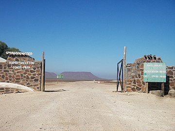 Springbok Gate, the eastern entry
 -
 Ugabmund Gate (Ugab River Gate), the southern entry
 -
 Collapsed oil drilling rig


See also[edit]
Notes[edit]
This park is to be included in the Iona – Skeleton Coast Transfrontier Conservation Area.
References[edit]
- ^ "Skeleton Coast Game Park". protectedplanet.net.
- ^ Shollenbarger, Maria. Mars on Earth: Traveling Namibia's Skeleton Coast. Conde Nast Traveler. January 25, 2018.
- ^ "Skeleton Coast Park" (PDF). Republic of Namibia - Ministry of Environment and Tourism. Archived from the original (PDF) on 2015-11-19.
- ^ Cadwalladr, Carole. Namibia’s Skeleton Coast. Financial Times. January 25, 2018.
- ^ "The photographs of Skeleton Coast National Park, October 2017". Independent Travellers. independent-travellers.com. Retrieved January 30, 2018.
This Africa protected areas related article is a stub. You can help Wikipedia by expanding it. |
This Namibia location article is a stub. You can help Wikipedia by expanding it. |