File:Algeria Map.jpg
Jump to navigation
Jump to search
Size of this preview: 500 × 600 pixels. Other resolutions: 200 × 240 pixels | 400 × 480 pixels | 640 × 768 pixels | 1,032 × 1,238 pixels.
Original file (1,032 × 1,238 pixels, file size: 240 KB, MIME type: image/jpeg)
Captions
Captions
Add a one-line explanation of what this file represents
Summary[edit]
| Description |
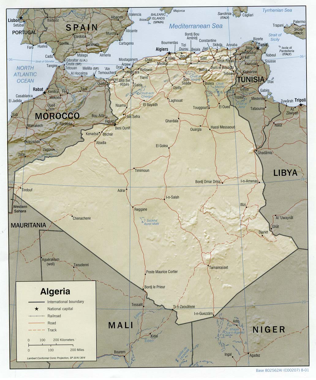
العربية: خريطة الجزائر المساعدة والمظللة، 2001. English: Shaded relief map of Algeria, 2001. |
| Date | |
| Source |
University of Texas Libraries, Perry-Castañeda Library Map Collection: Algeria Maps |
| Author | CIA |
Licensing[edit]
| This image is a work of a Central Intelligence Agency employee, taken or made as part of that person's official duties. As a Work of the United States Government, this image or media is in the public domain in the United States.
|

|
File history
Click on a date/time to view the file as it appeared at that time.
| Date/Time | Thumbnail | Dimensions | User | Comment | |
|---|---|---|---|---|---|
| current | 11:28, 21 February 2006 | | 1,032 × 1,238 (240 KB) | Lupo (talk | contribs) | Shaded relief map of Algeria. Source: [http://www.lib.utexas.edu/maps/africa/algeria_rel01.jpg] from the [http://www.lib.utexas.edu/maps/algeria.html Perry-Castañeda Library Map Collection]. {{PD-USGov-CIA}} Category:Maps of Algeria |
You cannot overwrite this file.
File usage on Commons
The following 4 pages use this file:
File usage on other wikis
The following other wikis use this file:
- Usage on als.wikipedia.org
- Usage on ar.wikipedia.org
- Usage on azb.wikipedia.org
- Usage on de.wikipedia.org
- Usage on de.wiktionary.org
- Usage on el.wikipedia.org
- Usage on en.wikipedia.org
- Usage on eo.wikipedia.org
- Usage on fo.wikipedia.org
- Usage on frr.wikipedia.org
- Usage on fr.wikipedia.org
- Usage on hr.wiktionary.org
- Usage on hu.wikipedia.org
- Usage on hu.wiktionary.org
- Usage on incubator.wikimedia.org
- Usage on it.wikipedia.org
- Usage on lb.wikipedia.org
- Usage on ms.wikipedia.org
- Usage on no.wikipedia.org
- Usage on no.wikinews.org
- Usage on ru.wikipedia.org
- Usage on sd.wikipedia.org
- Usage on sl.wikipedia.org
- Usage on szy.wikipedia.org
- Usage on uk.wikipedia.org
- Usage on ur.wikipedia.org
- Usage on vi.wikipedia.org
- Usage on www.wikidata.org
- Usage on zh.wikipedia.org